Río Piedras Terrain Vagues
Río Piedras is a former municipality of Puerto Rico and home of the University of Puerto Rico’s main campus. Founded in 1714, it served as the node that connected main roads such as the Avenida 65 Infantería (65th Infantry Avenue), the Ponce de León Avenue and the Puerto Rico highway 52, all of wich connected to the municipalities of Old San Juan and Carolina.
Though being a phase of Rio Piedra’s modernization, the development of the 65th avenue’s infrastructure by the 1950s segregated southern communities such as Venezuela and Buen Consejo. This intervention left behind massive terrain vagues that cut down the continuity of the urban grid. Yet, as Rem Koolhaas once said, these spaces, the terrain vagues, are the ones to take in consideration, they are essential.
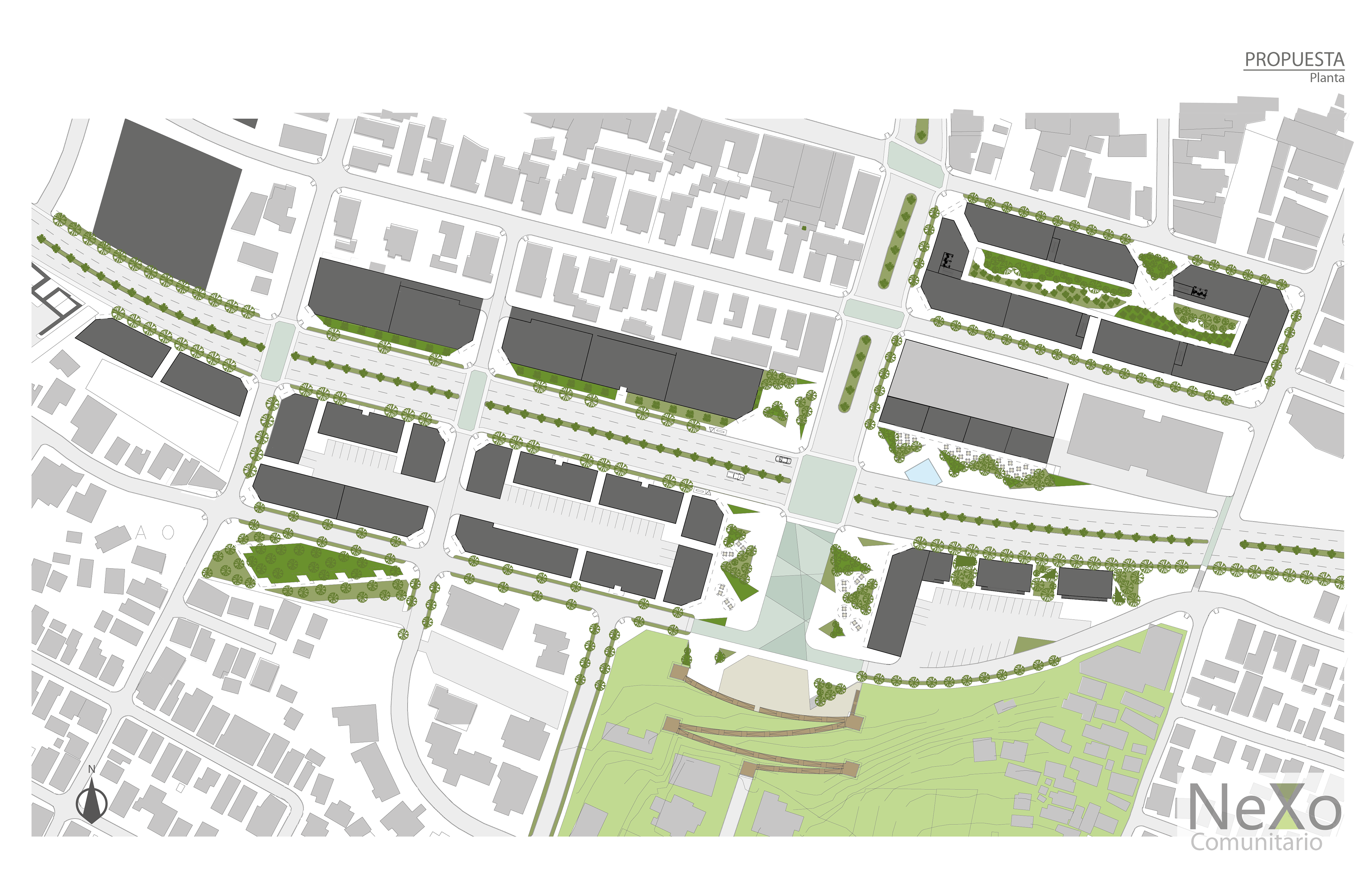
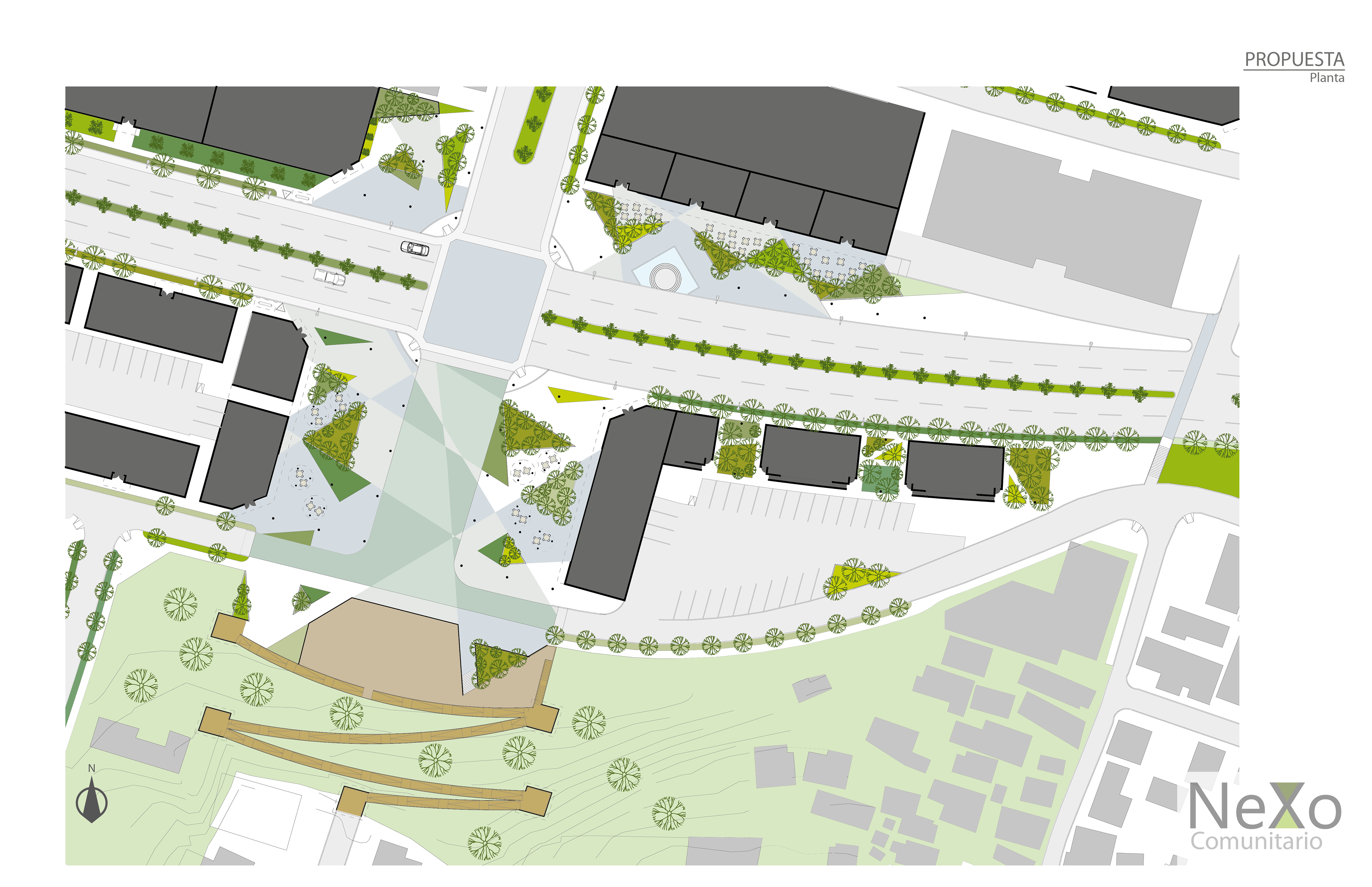
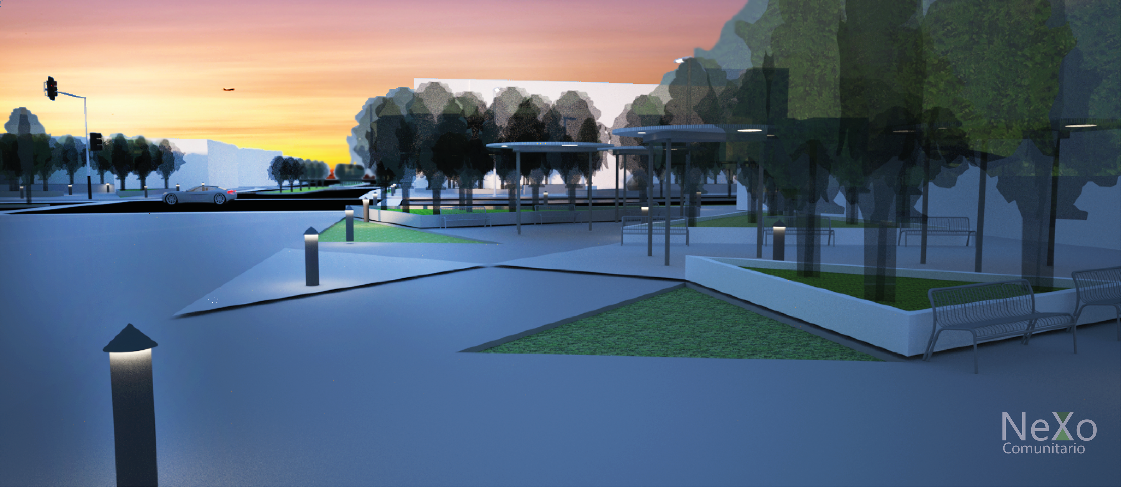
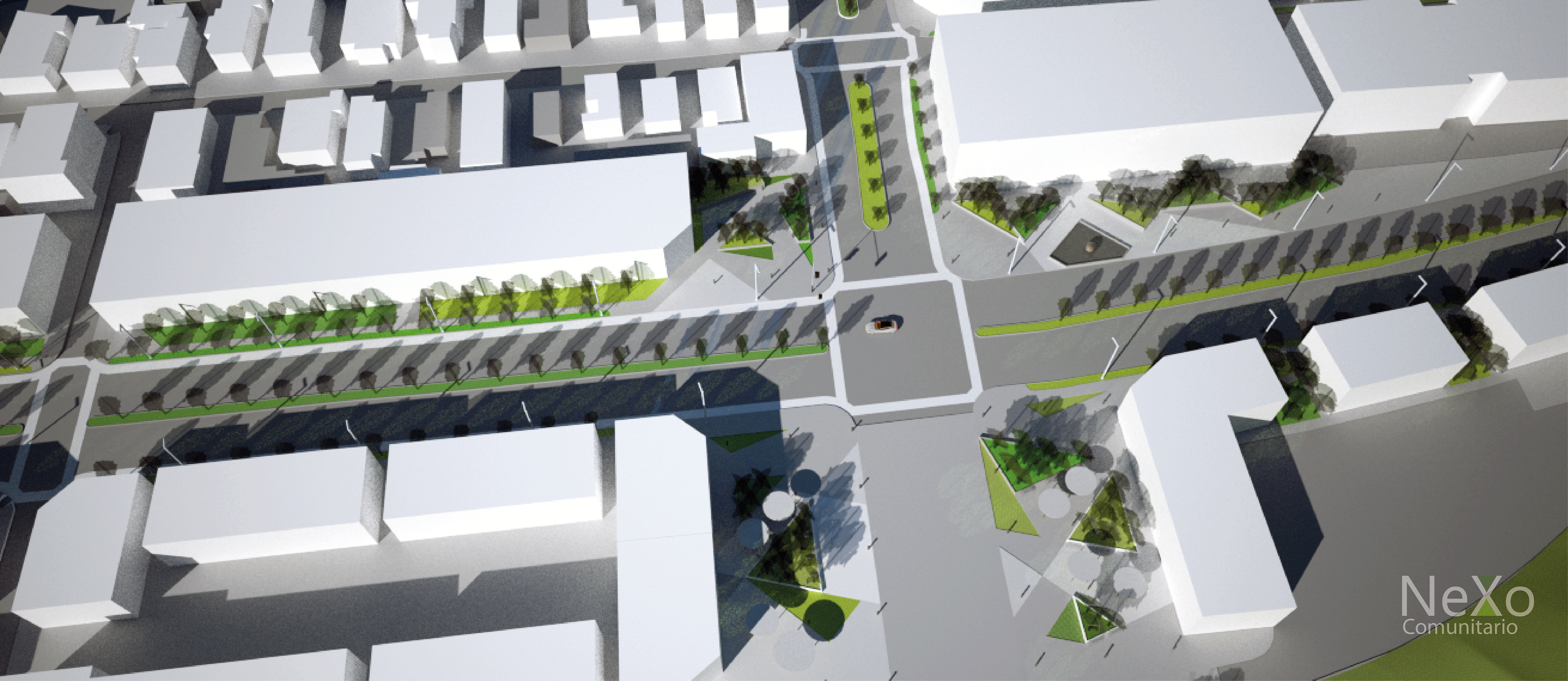
The Nexo Comunitario Concept (The Community Nexus Concept) proposes the elimination of the infrastructure by reestablishing the original condition before the 1950s decade. This allows the establishment of a main intersection that articulates the main entrance to the town and also domesticates the relatively high traffic it holds. Also, by reassembling the urban grid, it establishes programs mainly of commerce, to activate the area while having a main public space between the sides of the intersection; they promote the pedestrian flow from one side to the other. This, alongside other intentions such as a bike lane and the establishment of pedestrian strolls down the rough slopes, helps Río Piedras gain a more inclusive urbanistic composition throughout a joint, an urban knot; a community nexus.
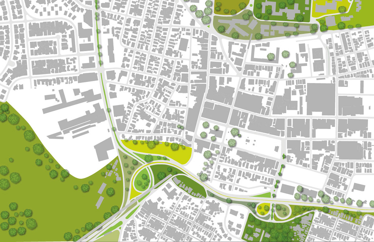
Río Piedras as of now.
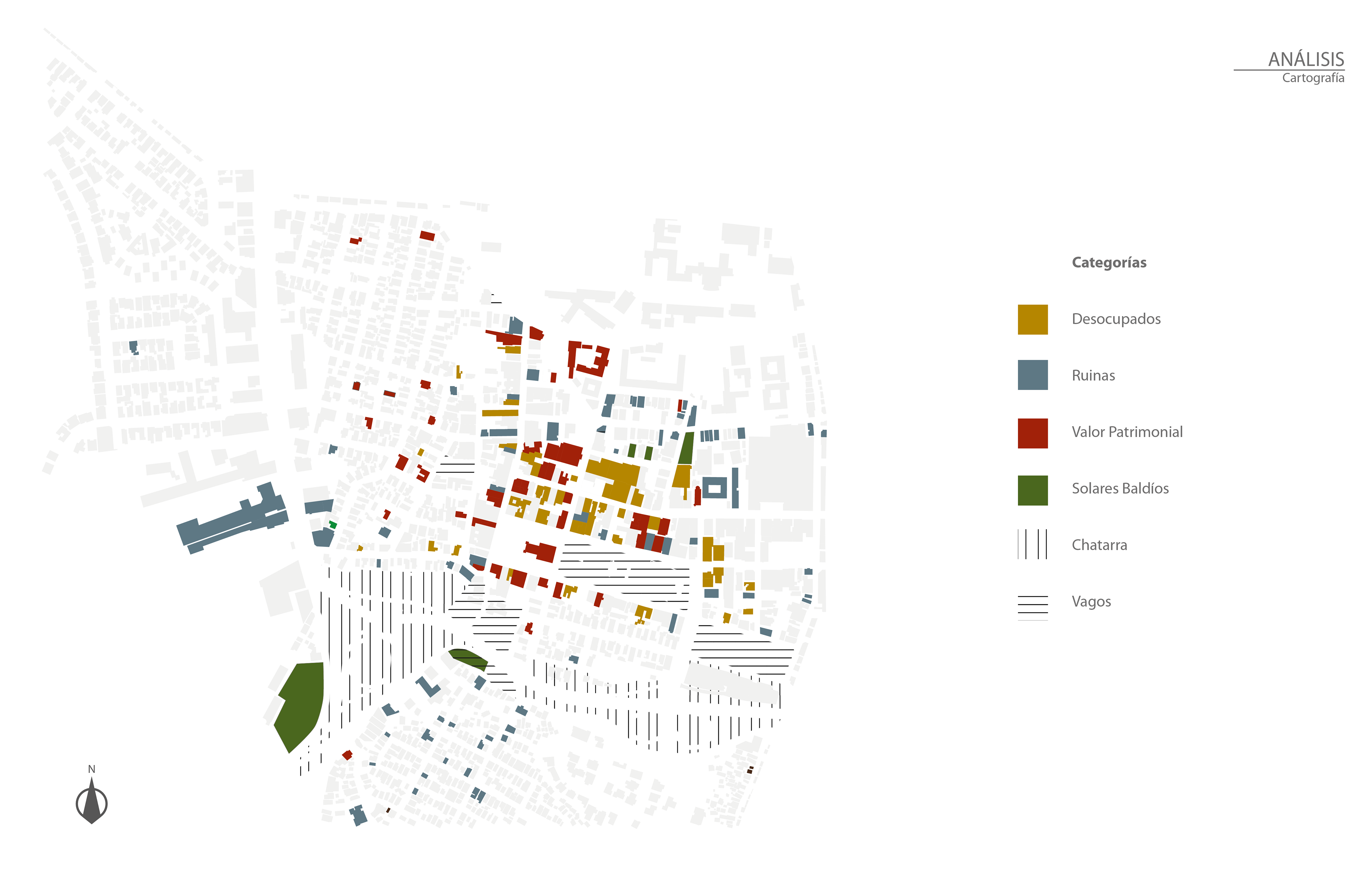
This Cartographic Analisis shows the massive terrain vagues and "junk" terrains (vertical and horizontal lines) witch, in terms of area, you coud fit one or two town blocks in there. Thats how big it is.
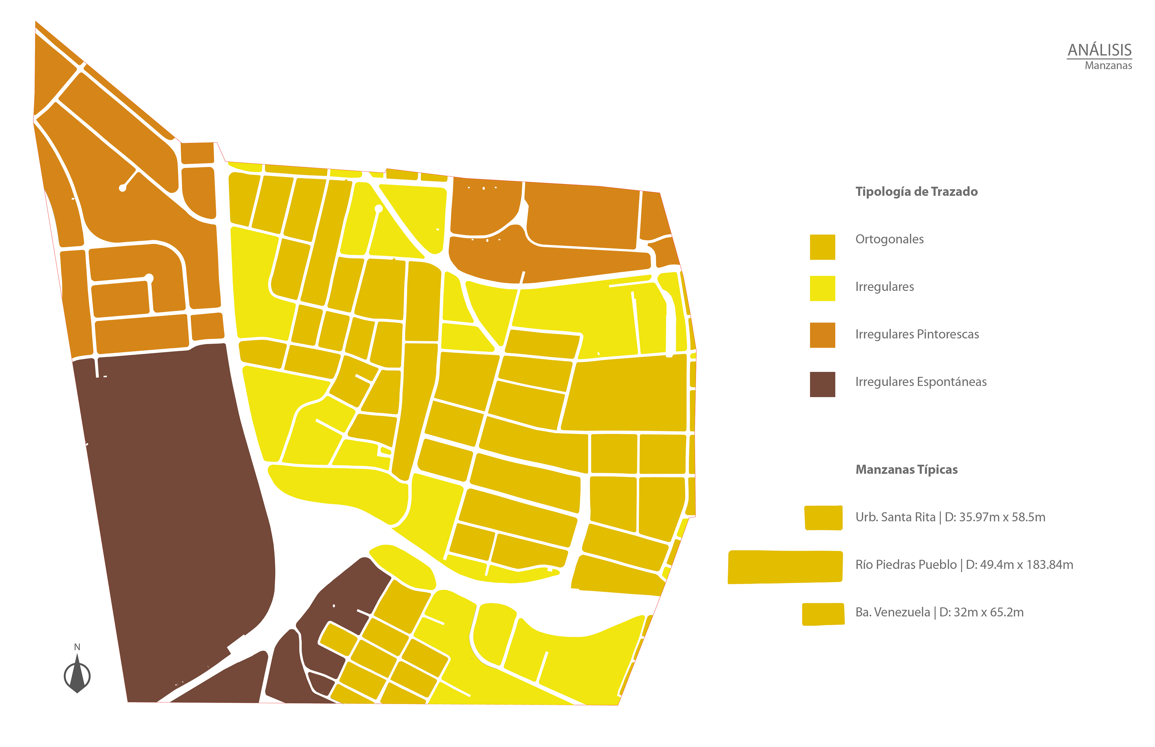
Block Analisis
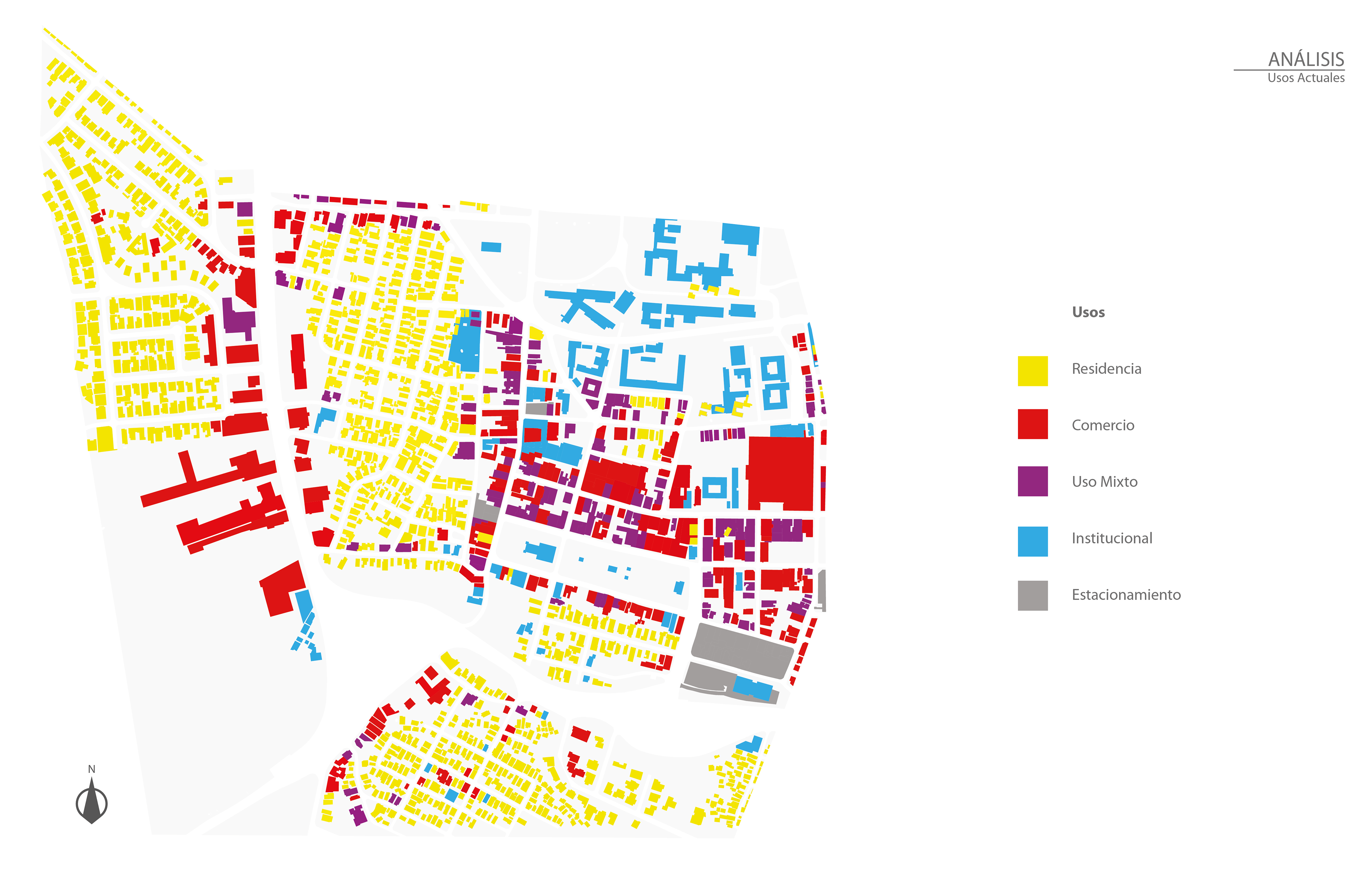
This is an analisis of current uses. Notice that the commerce (red) is concentrated in the town, yet, the infrastructure (down) being there, the southern communities can not easily access it.
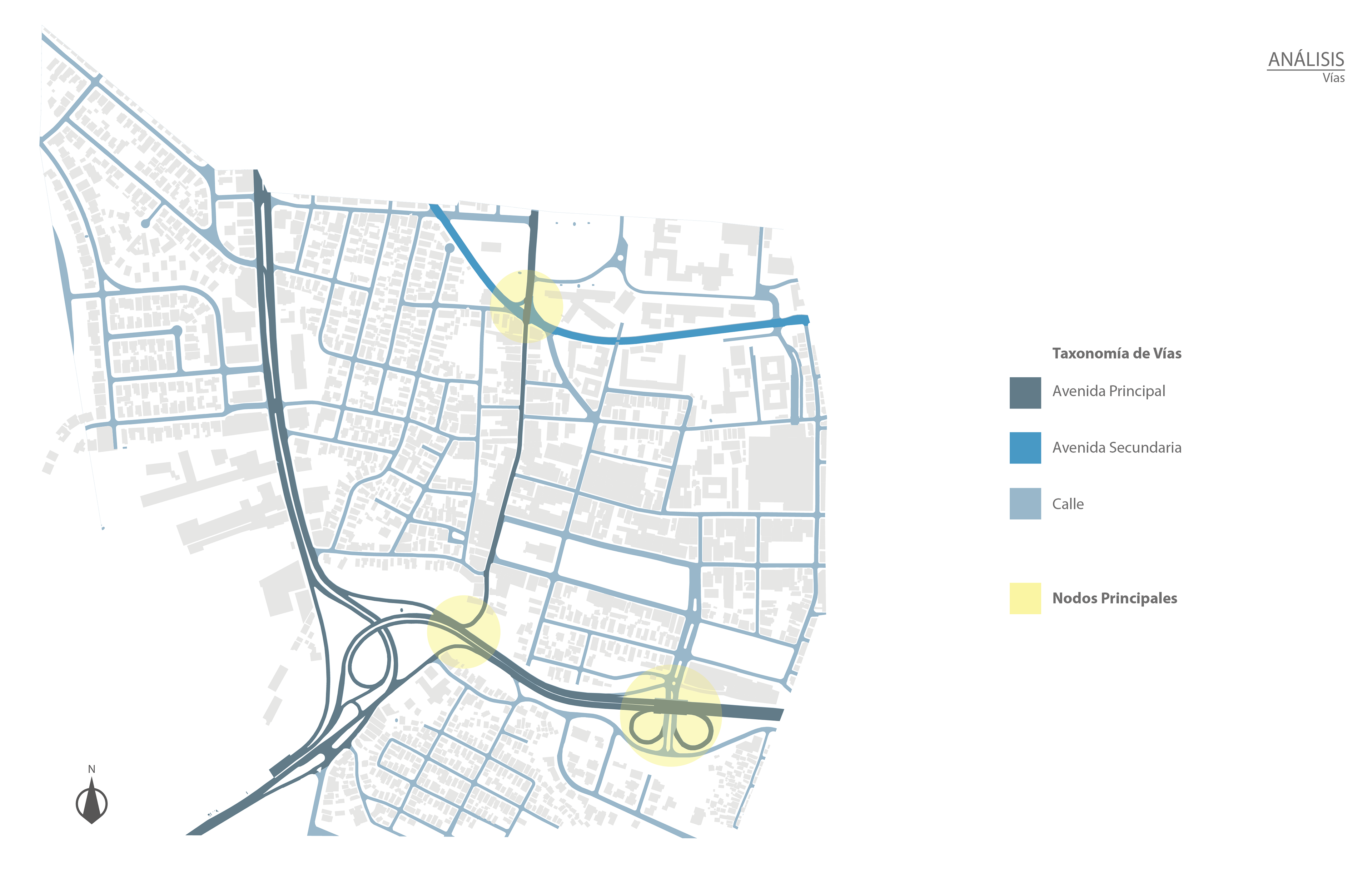
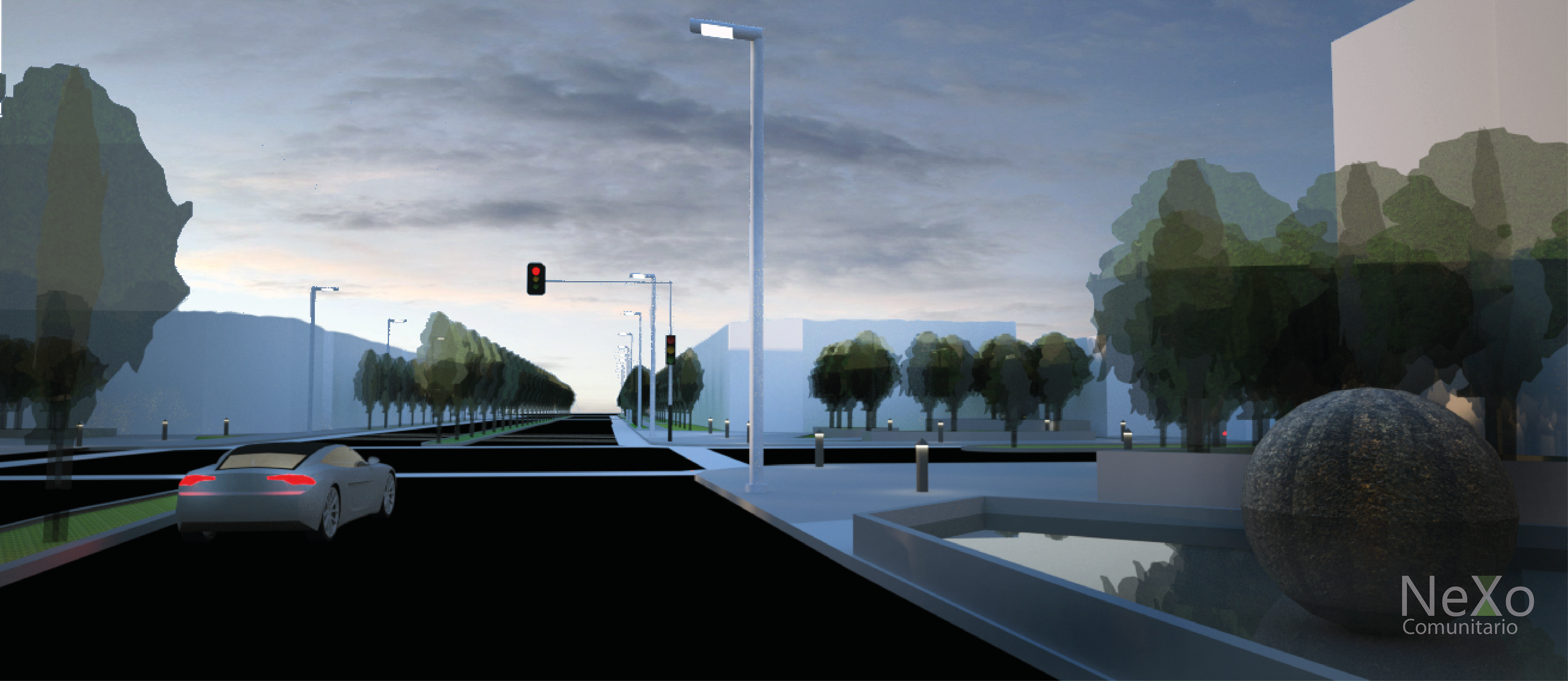
The shown eastern node is the principal entrance to Río Piedras. A bad entrance to a town indeed, it lacks prominence, and, as Andrés Duany would say, it makes the car happy.
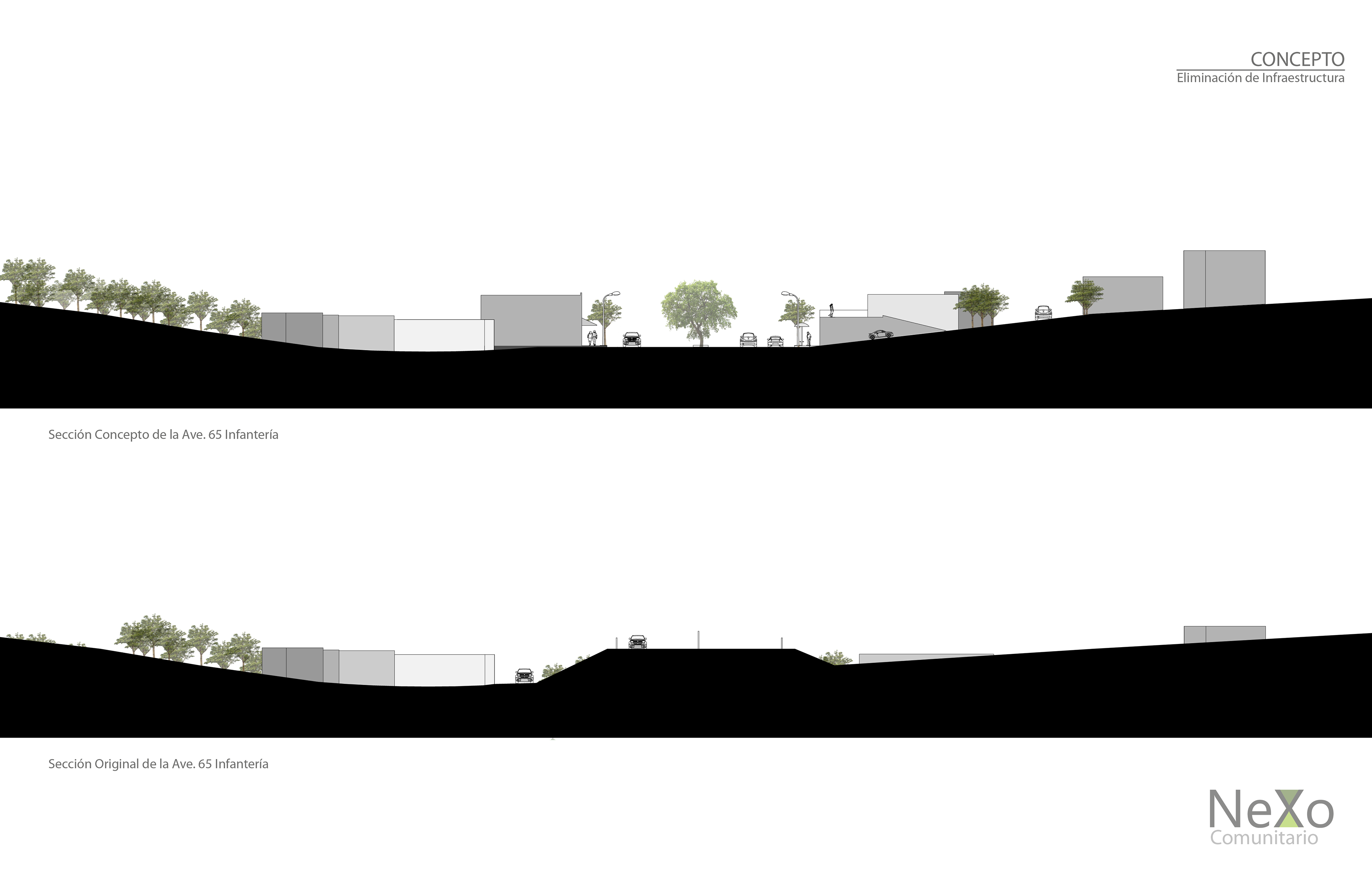
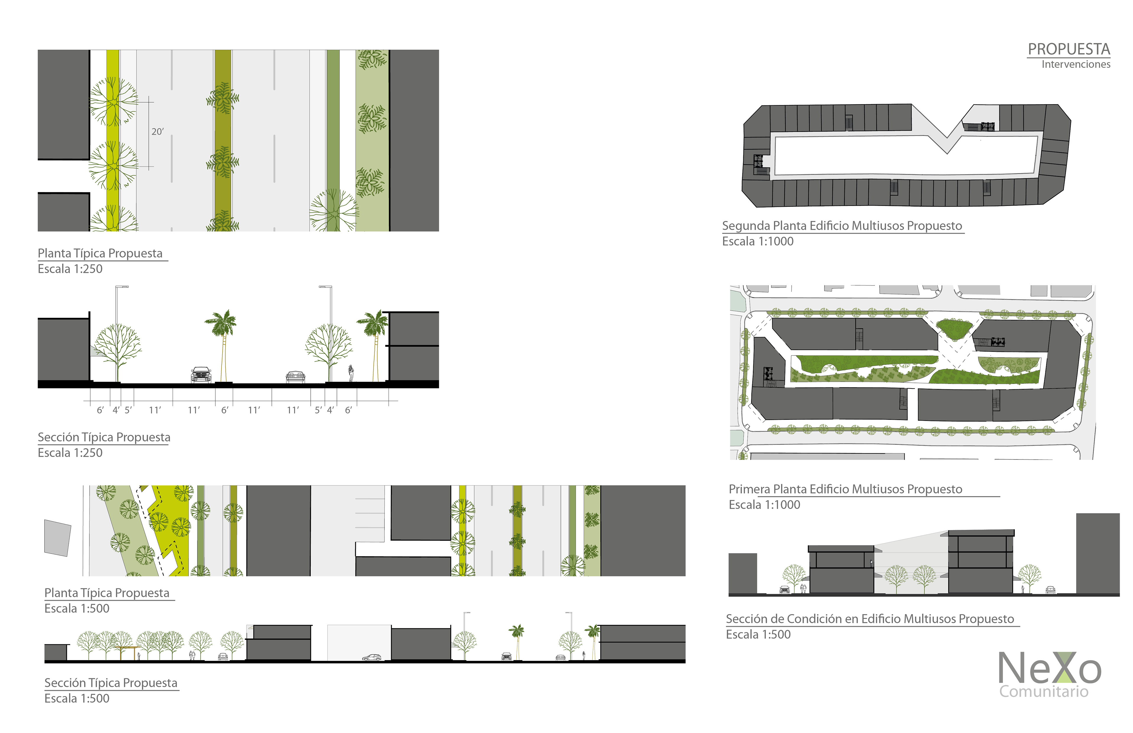
Proposed section concept of the road vs. the original one
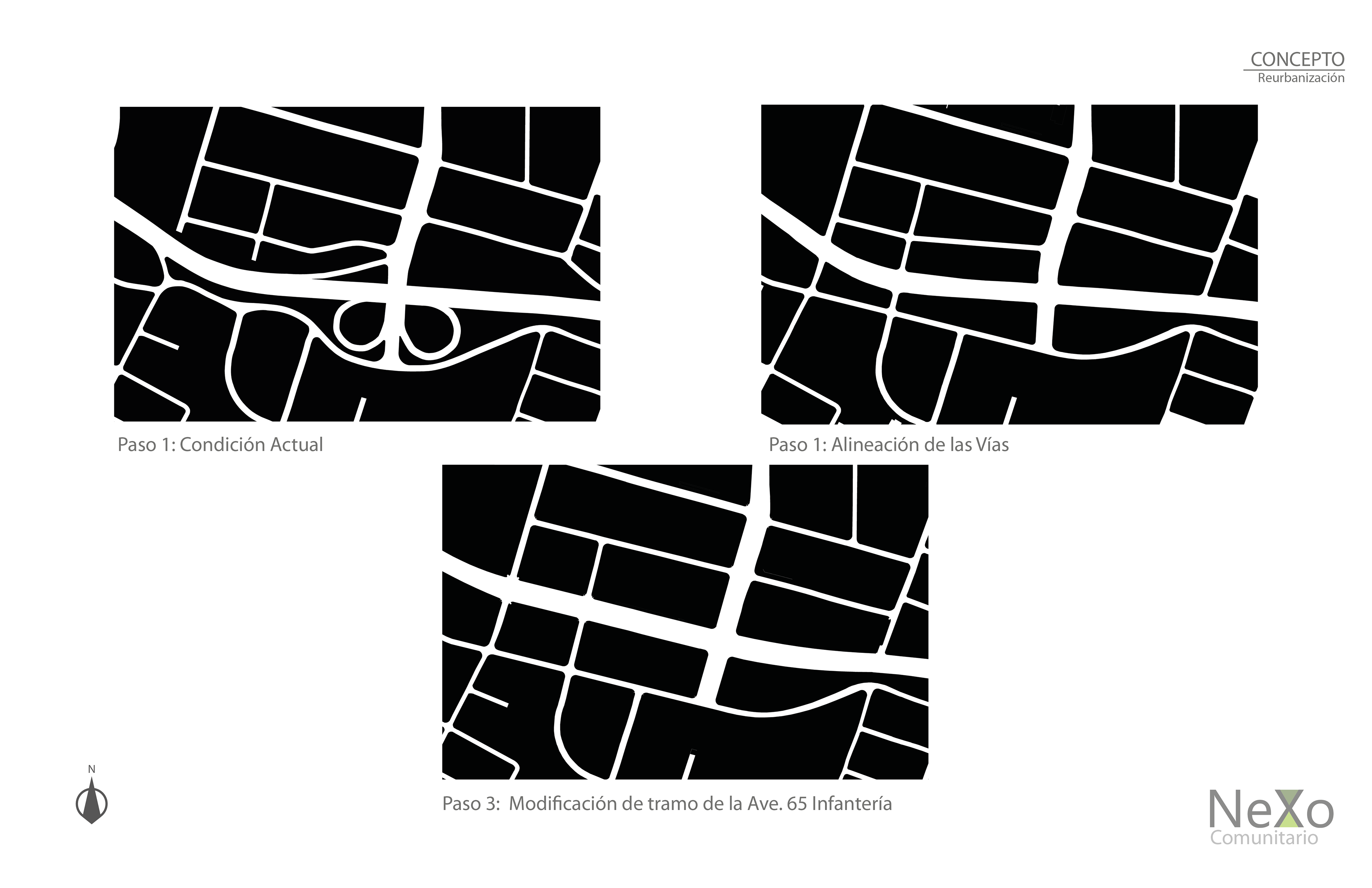
In an initial phase, the analisis of the current grid.
In a second phase, reuniting the old roads
In a third phase, dephasing 65th Infantry Avenue to give continuity to the blocks
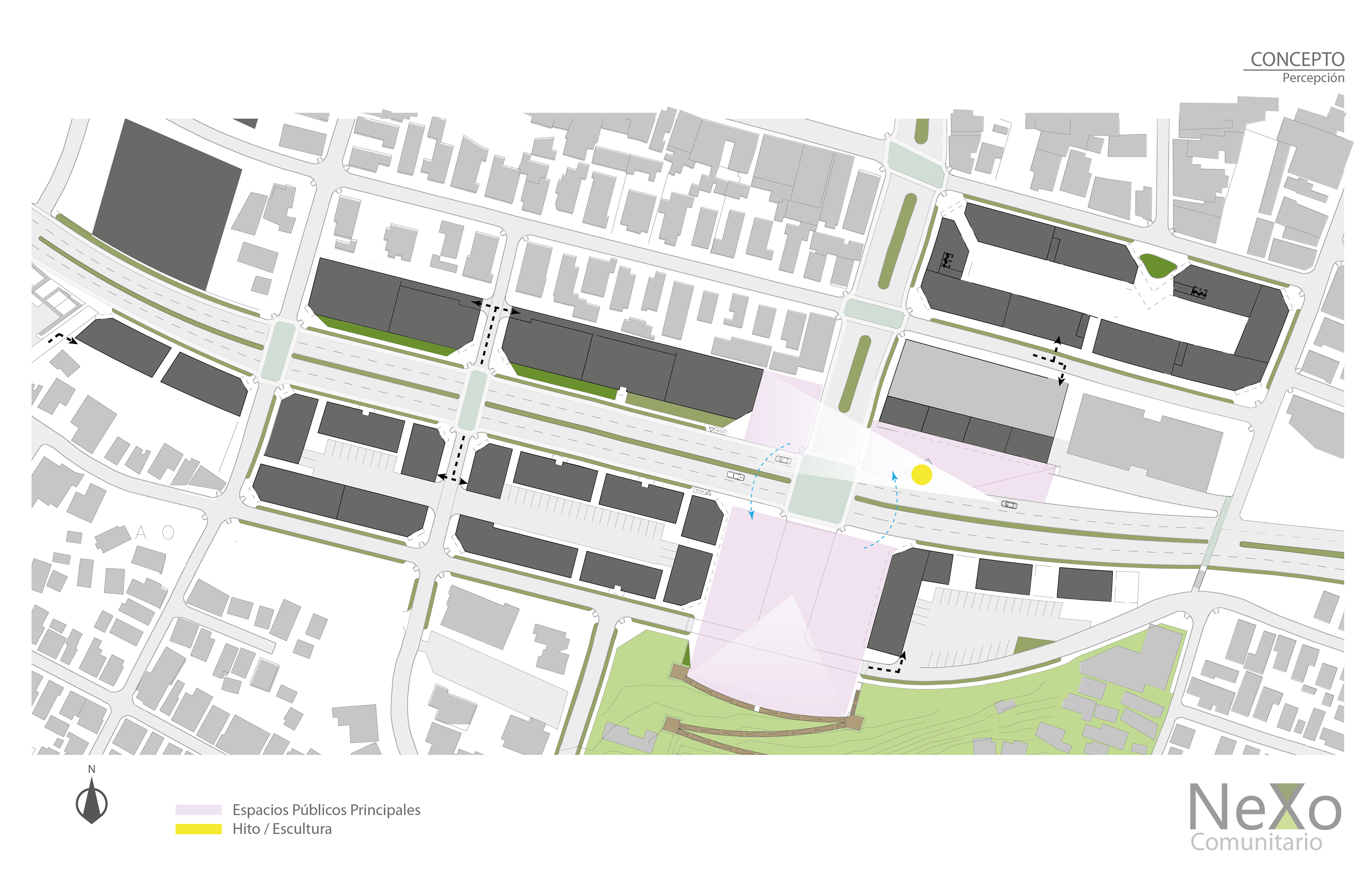
The importance of the perception of a town entrance; the prominence
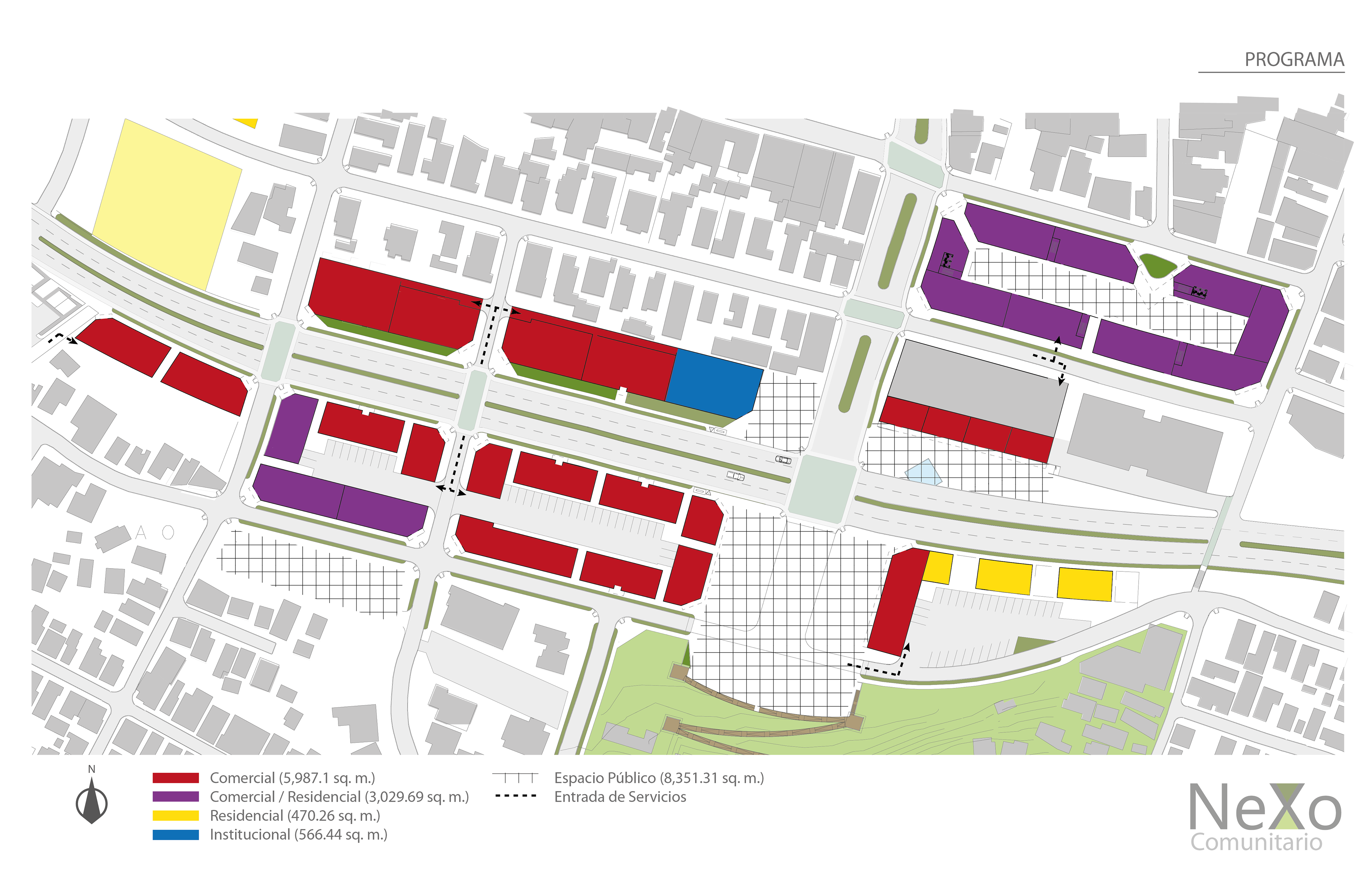
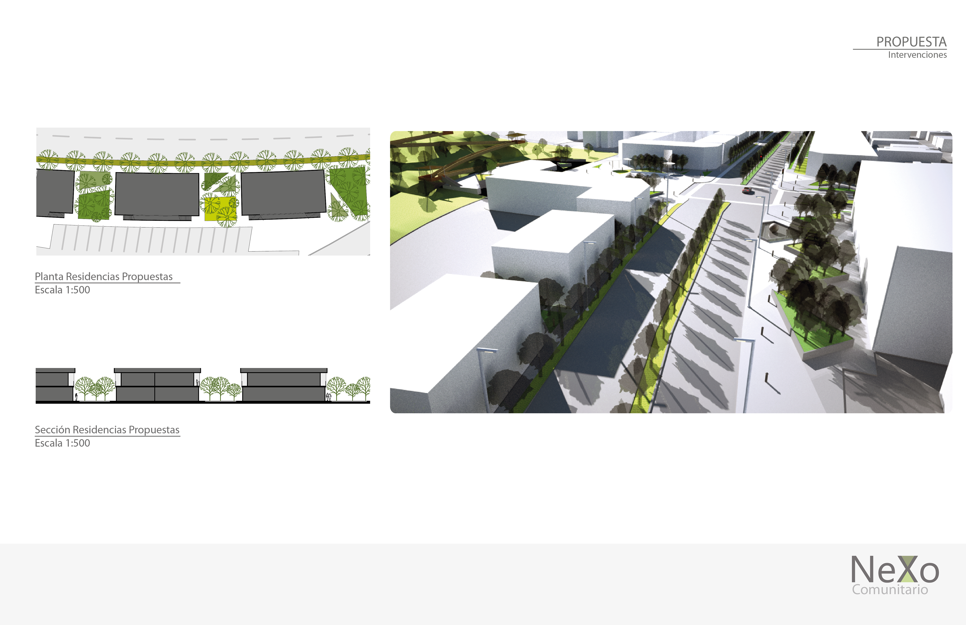
This is the propposed program. Mixed use buildings (violet) look predominantly to public spaces.